South - Mankota - Hwy 18
Add to Suitcase
Latitude: 49.41918° N,
Longitude: -107.0721° W
Longitude: -107.0721° W

Mankota


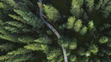
Mankota is located along Hwy 18 in the southern part of the province between the East and West Blocks of Grasslands National Park. Settlers from Manitoba and North Dakota started arriving in the area in 1910, hence the name "Mankota."
TRAVELLER INFO
Village office, 262 - 1st Ave, Mon to Thu 9 a.m. - 4 p.m.
Gas station, 8 a.m. - 5 p.m.; Petro Canada cardlock.
306-478-2331
Email: village.mankota@sasktel.net
South - Mankota - Hwy 18
Mankota1.jpg
Mankota is located along Hwy 18 in the southern part of the province between the East and West Blocks of Grasslands National Park. Settlers from Manitoba and North Dakota started arriving in the area in 1910, hence the name "Mankota."
Mankota
Latitude: 49.41918° N,
Longitude: -107.0721° W
Longitude: -107.0721° W
TRAVELLER INFO
Village office, 262 - 1st Ave, Mon to Thu 9 a.m. - 4 p.m.
Gas station, 8 a.m. - 5 p.m.; Petro Canada cardlock.
306-478-2331
Email: village.mankota@sasktel.net