
Central - Nipawin
Public Trails
Add to Suitcase
Nipawin.
Latitude: 53.36218° N,
Longitude: -104.0141° W
Longitude: -104.0141° W
Town of Nipawin is home to abundant opportunities for trail enthusiasts. In and around the community, there are outstanding trails that are perfect for walking, hiking, cycling, cross-country skiing and snowmobiling. The community features four main trails - the Central Park Walking Trails, Murals of Nipawin Guided Walking Tours, the Hospital Grounds Walking Trail and the Walleye Trail - as well as roughly 300 km of groomed snowmobile trails just outside of the town's limits.
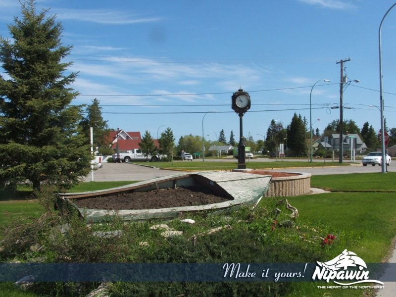
Central Park Walking Trails: 2-km loop walking and cycling trail travels through the town's beautiful 19-hectare Central Park. During your trip, you will pass along the park's track and field racetrack, grandstand, ball diamonds, playground and horseshoe pits. The park is also home to an arena and outdoor swimming pool.
Murals of Nipawin Guided Walking Tours: this guided walking tour features 13 outstanding murals that depict stories from the town's history. While walking around town, your guide will reveal the stories behind the murals and the artists who painted them. To either book a tour or for more information, call 306-862-3615.
Hospital Grounds Walking Trail: this short walking trail features the town's Pineview Lodge and Hospital’s scenic grounds.
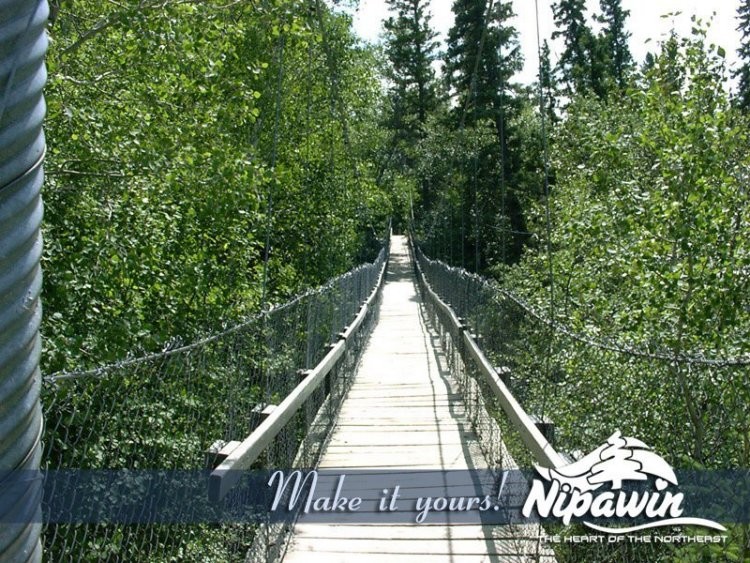
Walleye Trail: 1 km long trail that joins Nipawin and the Nipawin Regional Park. Trail features beautiful scenery and a variety of unique flowers including orchids and yellow Lady's slippers. It also features grass, sand and natural terrain plus some wet areas depending on the time of year. The trail also connects to several other trails within the regional park including the Ochre Trail, Pike Trail, Perch Trail, Rainbow Trail and Sturgeon Trail.
An added bonus of the Walleye Trail is that it doubles as a hiking, walking and cycling trail in the spring, summer and fall, and as part of a network of cross-country ski trails in the winter. Between the trails built in Nipawin's Evergreen Golf Course and the network of trails created from the Walleye Trail and regional park trail network, the area boasts roughly 10 km of groomed trails every winter. The location of the cross-country ski trails can be found in the Walleye Trail Map.
After reaching the Nipawin Regional Park, be sure to check out the park’s other activities and amenities.
Central Park Walking Trails: 2-km loop walking and cycling trail travels through the town's beautiful 19-hectare Central Park. During your trip, you will pass along the park's track and field racetrack, grandstand, ball diamonds, playground and horseshoe pits. The park is also home to an arena and outdoor swimming pool.
Murals of Nipawin Guided Walking Tours: this guided walking tour features 13 outstanding murals that depict stories from the town's history. While walking around town, your guide will reveal the stories behind the murals and the artists who painted them. To either book a tour or for more information, call 306-862-3615.
Hospital Grounds Walking Trail: this short walking trail features the town's Pineview Lodge and Hospital’s scenic grounds.
Walleye Trail: 1 km long trail that joins Nipawin and the Nipawin Regional Park. Trail features beautiful scenery and a variety of unique flowers including orchids and yellow Lady's slippers. It also features grass, sand and natural terrain plus some wet areas depending on the time of year. The trail also connects to several other trails within the regional park including the Ochre Trail, Pike Trail, Perch Trail, Rainbow Trail and Sturgeon Trail.
An added bonus of the Walleye Trail is that it doubles as a hiking, walking and cycling trail in the spring, summer and fall, and as part of a network of cross-country ski trails in the winter. Between the trails built in Nipawin's Evergreen Golf Course and the network of trails created from the Walleye Trail and regional park trail network, the area boasts roughly 10 km of groomed trails every winter. The location of the cross-country ski trails can be found in the Walleye Trail Map.
After reaching the Nipawin Regional Park, be sure to check out the park’s other activities and amenities.
Access
- Country / Rural
Services
- Self-guided tour
Amenities
- Free parking
- Warm-up shelter(s)
Activities
- Cross-country skiing
- Cycling
- Hiking
- Snowmobiling
Contact Info
Phone(s):
306-862-9866 |
Nipawin.
Latitude: 53.36218° N, Longitude: -104.0141° W
Central - Nipawin

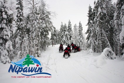
Town of Nipawin is home to abundant opportunities for trail enthusiasts. In and around the community, there are outstanding trails that are perfect for walking, hiking, cycling, cross-country skiing and snowmobiling. The community features four main trails - the Central Park Walking Trails, Murals of Nipawin Guided Walking Tours, the Hospital Grounds Walking Trail and the Walleye Trail - as well as roughly 300 km of groomed snowmobile trails just outside of the town's limits.
Central Park Walking Trails: 2-km loop walking and cycling trail travels through the town's beautiful 19-hectare Central Park. During your trip, you will pass along the park's track and field racetrack, grandstand, ball diamonds, playground and horseshoe pits. The park is also home to an arena and outdoor swimming pool.
Murals of Nipawin Guided Walking Tours: this guided walking tour features 13 outstanding murals that depict stories from the town's history. While walking around town, your guide will reveal the stories behind the murals and the artists who painted them. To either book a tour or for more information, call 306-862-3615.
Hospital Grounds Walking Trail: this short walking trail features the town's Pineview Lodge and Hospital’s scenic grounds.
Walleye Trail: 1 km long trail that joins Nipawin and the Nipawin Regional Park. Trail features beautiful scenery and a variety of unique flowers including orchids and yellow Lady's slippers. It also features grass, sand and natural terrain plus some wet areas depending on the time of year. The trail also connects to several other trails within the regional park including the Ochre Trail, Pike Trail, Perch Trail, Rainbow Trail and Sturgeon Trail.
An added bonus of the Walleye Trail is that it doubles as a hiking, walking and cycling trail in the spring, summer and fall, and as part of a network of cross-country ski trails in the winter. Between the trails built in Nipawin's Evergreen Golf Course and the network of trails created from the Walleye Trail and regional park trail network, the area boasts roughly 10 km of groomed trails every winter. The location of the cross-country ski trails can be found in the Walleye Trail Map.
After reaching the Nipawin Regional Park, be sure to check out the park’s other activities and amenities.
Contact Info
Phone:
306-862-9866 |