
North - Stony Rapids - E end of Lake Athabasca
Add to Suitcase
Latitude: 59.25445° N,
Longitude: -105.8351° W
Longitude: -105.8351° W
Stony Rapids
Stony Rapids
Stony Rapids, Northern Hamlet of


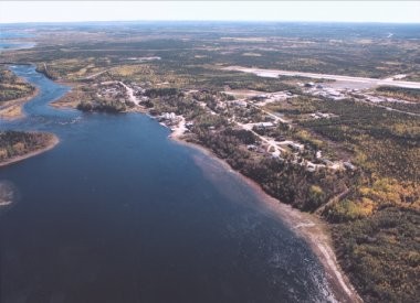
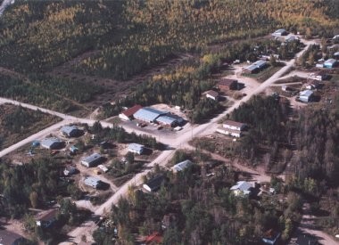
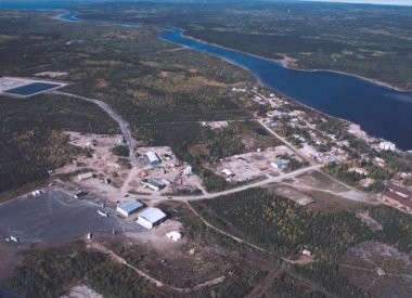
The northern hamlet of Stony Rapids is located on the east end of Lake Athabasca. It is approximately 80 km from the Saskatchewan/Northwest Territories border and accessible primarily by aircraft; although in 2006 a gravel road was built connecting the community to Points North Landing and gravel Hwy 905. Recreation facilities include a basketball court and baseball field. Stony Rapids Community School (K-9) and Pre-school for ages 0-6 years. Youth care home.
North - Stony Rapids - E end of Lake Athabasca
Stony Rapids
Stony Rapids
Stony Rapids, Northern Hamlet of
The northern hamlet of Stony Rapids is located on the east end of Lake Athabasca. It is approximately 80 km from the Saskatchewan/Northwest Territories border and accessible primarily by aircraft; although in 2006 a gravel road was built connecting the community to Points North Landing and gravel Hwy 905. Recreation facilities include a basketball court and baseball field. Stony Rapids Community School (K-9) and Pre-school for ages 0-6 years. Youth care home.
Stony Rapids
Latitude: 59.25445° N,
Longitude: -105.8351° W
Longitude: -105.8351° W